
blah blah blah
Dilly Cliffs
Length: 1.7 miles out-and-backDifficulty (click for info): Moderate
Elevation Gain: 640 feet (+240 feet on return)
Rating (click for info): 6/10
Elevation: 2507'
Driving Directions:
Trailhead and parking area are on Rt. 112 in Woodstock, NH, 3.5 miles northwest of Rt. 118 and 4.8 miles southeast of the eastern junction with Rt. 116. Park in the large lot for the Appalachian Trail crossing (Beaver Brook Trail) on the south side of the road, just south of Beaver Pond Scenic Area and just west of the Lost River visitor center and the height of land in Kinsman Notch. Click here for a Google map.
Trail map
About the Hike:
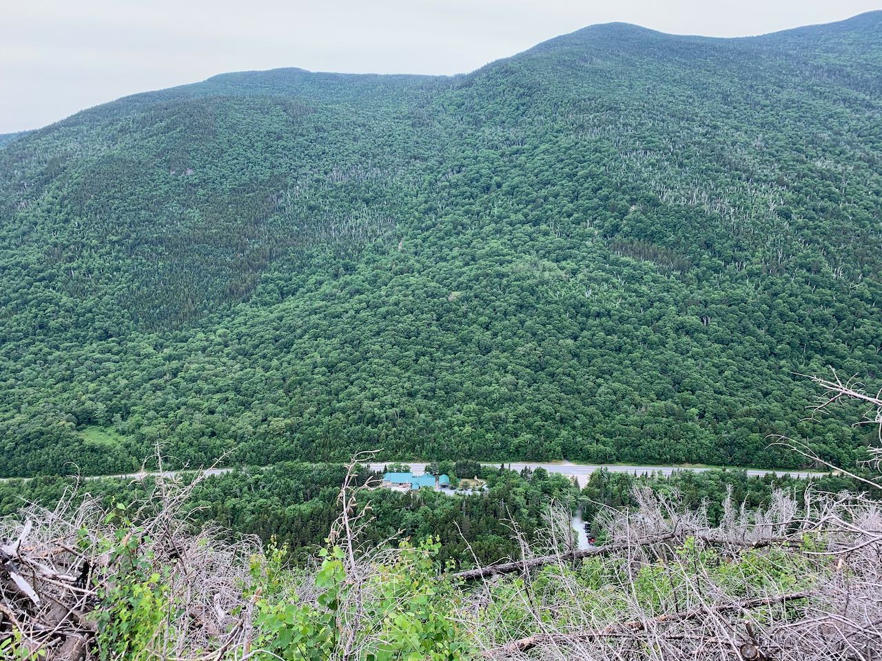
As you drive through Kinsman Notch, one of the major mountain passes of the White Mountains, you will notice the tortured slopes of the low yet looming Dilly Cliffs forming the north wall of the notch. As the southern bastion of the Kinsman Ridge, well-known by White Mountain hikers for its rugged character, the Dilly Cliffs stand guard over the famous Lost River attraction. Both the cliffs and Lost River are located within the Forest Society's Lost River Reservation. While the Lost River gorge and boulder caves bustle with tourists, the Dilly Cliffs are a more secluded corner of the property. Drastic changes came to the reservation in late 2017 when a forest fire scorched over the cliffs and surrounding forest. The fire was contained to a relatively small area, but the evidence remains today, and most of the Forest Society's Dilly Trail, which connected the Lost River visitor center with the top of the Dilly Cliffs, was permantly closed, being devastated by blowdowns and ash. One positive result of the change was that the view from atop the Dilly Cliffs was much improved and they now offer a wide, close-up view over Kinsman Notch, reachable by a short but taxing climb up the Kinsman Ridge Trail.
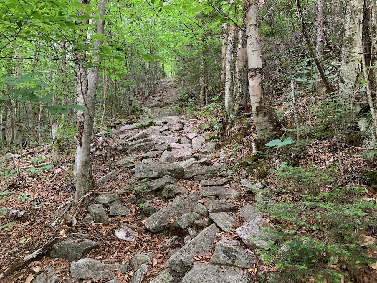
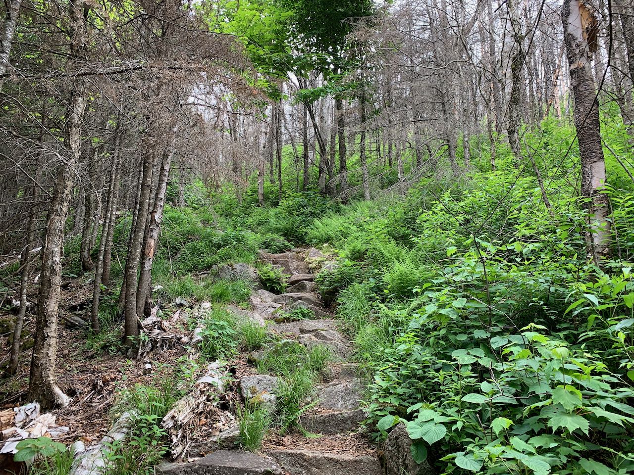
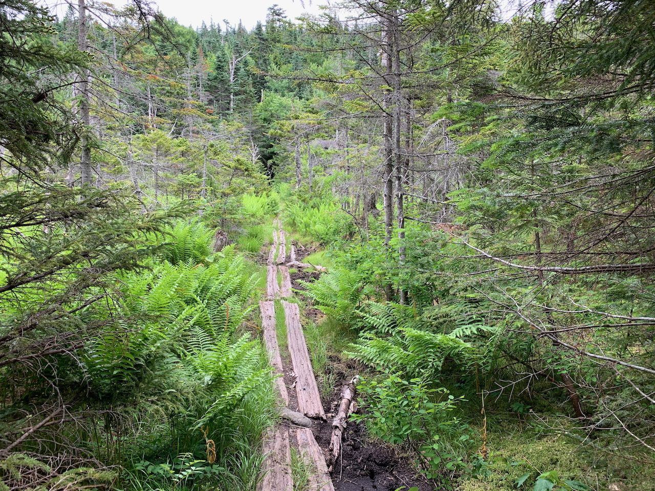
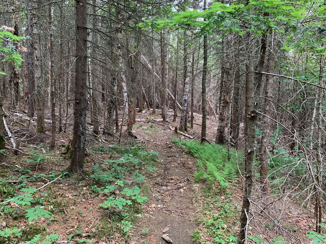
Begin your hike at the large parking area where the Appalachian Trail crosses Rt. 112. Most hikers here will be heading south on the Beaver Brook Trail to climb Mt. Moosilauke. Head over to the kiosk on the north side of the parking area, near the back. Walk out to the Appalachian Trail and turn right. Carefully cross the road and climb a steep stone staircase on the other side into the forest. The trail ascends very steeply, gaining height over the road quickly. After climbing an impressive 200 feet in little over 0.1 miles, the trail makes a switchback and heads across the slope at a gentler grade, reaching the edge of the burned area after a total of a quarter mile from the start. Tall brush and defoliated trees characterize the area. You have some views through the sparse vegetation across the notch as the trail again turns directly uphill and resumes its relentless ascent. The trail remains in the burned zone for a bit, then climbs back into the forest. The brutal grade moderates, then after 0.2 miles it levels off. The trail dips slightly and crosses an open bog on a short boardwalk and ascends easily onto the shoulder of an unnamed summit above the Dilly Cliffs after another 0.2 miles. In another flat section, amidst open forest, reach a junction (may be unmarked) with the blue-blazed Dilly Trail. Turn right and descend gently through the beautiful forest. The trail winds downhill, steepening briefly before bearing left and emerging in a clearing above the cliffs. From here you overlook the valley of Lost River, leading south from the top of Kinsman Notch. Looking directly below, you can see the road and the Lost River visitor center. Across the way, the massive ridge leading down from Mt. Blue over Mt. Jim and Mt. Waternomee blocks the view of Mt. Moosilauke's summit. Out the notch to the east, you look off to Mt. Osceola, Mt. Tripyramid, Mt. Tecumseh, and Sandwich Dome.
Printable directions page